Urban exploration workshop for migrants in Cahors
Our UrbEX workshop took place in Cahors, a town located in the LOT district of the Occitanie region in France. The town covers an area of 593km2 and has a population of approximately 20,000 inhabitants, as per the official 2017 demographic statistics. Within this population, around 10% are migrants. The collaboration between UrbEX and the city of Cahors was initiated through the AMIgrant Association. Nomadways, UrbEX French partner, approached this reality with the aim of presenting the project and jointly developing urban exploration workshops for its members.
ABOUT THE LOCAL SETTING
AMIgrant Cahors is an association that was established in 2021 and is dedicated to supporting and empowering individuals with refugee status, international protection, or asylum seekers in their integration journey, by providing a social gathering space for their associates. The association's premises are situated along the river that surrounds the city, serving as a natural boundary between the centre and the suburbs. The association offers free services that primarily focus on literacy, French language and computer classes, legal-administrative assistance, social activities, and local exploration. In collaboration with entrepreneurial and associative entities in and around Cahors, AMIgrant volunteers organise monthly extraordinary activities for territorial exploration. It is within this framework that Nomadways proposed co-creating the urban exploration workshop, tailoring the experience to the specific needs and abilities of the participants, aimed at fostering community engagement, intercultural understanding, and personal development.
Methodology
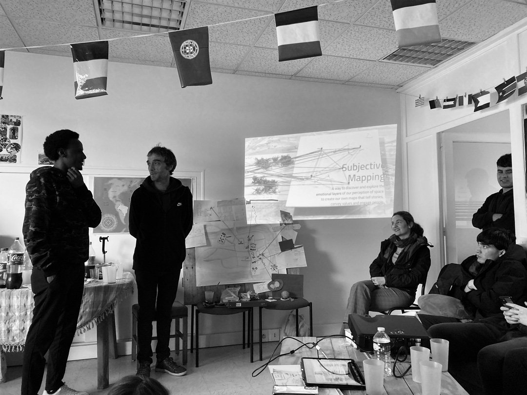
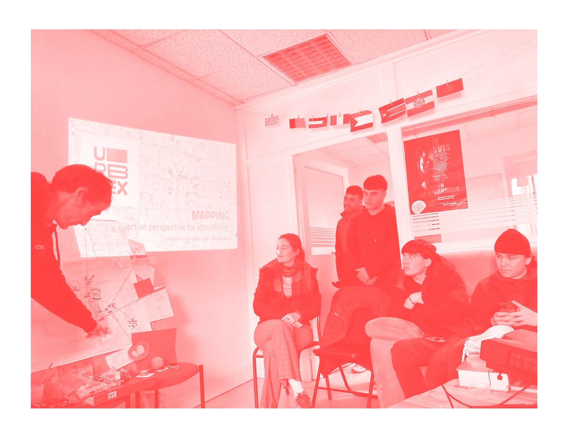
The proposed methodology was that of Subjective Mapping: a way to discover and explore the emotional layers of our perception of space in order to create our own maps that tell stories, convey values, and engage people.
We start by considering a map as a "coded, compact representation of reality" (Hugo Herrera Tobon). By coding, we mean making choices by classifying and simplifying different layers of information. Hence, a map helps people relate to and imagine large places where they can position themselves. However, despite their apparent objectivity, maps select and even distort reality. In fact, mapping is an art form that expresses our perceptions, including biases and choices. The way we display things, colours, lines, is a reflection of how we see the world, and this is where the personal becomes political. A map presents a place that seems to exist independently of being observed, even though it is the result of choices and reality distortion. Distortions can be practical, such as making streets broader in an atlas to accommodate legible street names. At the end of the day, a "well-made" map serves its purpose precisely through its selectivity, and that's why intention matters. When observing or creating, we should ask ourselves: "From where do we map?" "From where did the creator map?" It is important to remember that maps may seem to represent reality as truth, but they actually reflect personal or shared ideas.
The choices we make when creating a map, the way we represent it, come from who we are, what we do, and the culture we are part of. Any choice made in the context of showing a territory or space is political. Therefore, a map can never be neutral. The choices we make when mapping hold immense power because they can influence the perception of those who view them, as we are essentially telling the world what the truth is. A map has the power to display truth, one's own truth. Map-making, even the seemingly most objective, arises from who we are and what we believe.
in mapping, physical peripheral areas often become metaphorically peripheral as well. We give more importance to what is closer to our field of view, while relegating things we consider less important to the edges of our sight. Often, dominant groups assume that the shape of their world is the shape of the world itself. However, different groups live in differently shaped worlds that can be mapped in various ways. James Riding stated, "maps don't represent reality, but they create reality". This cultural geographer's work piqued our interest due to his purpose of finding new ways to creatively and critically narrate geographies of place, region, and landscape through oral history, ethnographic exploration, and performative interventions in a variety of spaces.
Considering these concepts relevant to the AMIgrants community, we decided to embrace the subjective mapping approach for this URBEX Local Lab. As we mentioned before, maps possess unparalleled storytelling power, and subjective mapping is a way to express our feelings about a place or a journey. It can help explore a place as a tool for intercultural understanding, inclusion, active participation, and community development.
We began by choosing a relevant city space within which to organise the urban exploration workshop. We then created a custom game for our participants, focusing on subjective observations through visual, audio, and tactile senses.
HOW IT WORKS
Subjective maps can be visualised in various ways, each telling a unique story. Drawing and typography are used by artists like Stephen Walter and Christine Shannon Rankin to capture the psychogeographies of cities and portray personal experiences. Becky Cooper, an accidental cartographer, realised the subjectivity of mapping while mapping Manhattan's public art, leading her to create a collaborative portrait of the city based on individual stories and impressions.
Installation, sculpture, and collage techniques, as demonstrated by Shannon Christine Rankin, transform maps into revised versions resembling the terrains they represent. This exploration of geological and biological processes, patterns in nature, and geometry invites viewers to reflect on their relationship with the world.
Photographic maps assemble pictures to create recognizable representations. Sohei Nishino uses generic photographs of main monuments, while Stephen Walter's approach involves assembling pieces of personal pictures, capturing the essence of a city.
Soundscape mapping records environmental sounds without interference, including natural elements like wind and water, as well as human activities such as music and traffic. Sensorial mapping engages multiple senses—sound, tactile, gustatory, and olfactory—to create an immersive experience of a place. Participants collaborate to create maps based on these sensory dimensions, exploring sound directions, tactile journeys, taste experiences, and the identification of spaces through smells.
Mapping can also be approached through storytelling, which involves sharing stories to pass information and shape subjective maps. It is a social and cultural activity that dates back to the earliest forms of communication.
By integrating diverse mapping approaches, utilising multi-sensory inputs, and embracing storytelling, subjective maps reveal personal narratives about a territory, offering a rich and multidimensional understanding of places. With all these inspiring examples in mind, we embarked on the co-creation of a city exploration experience that could be both meaningful and empowering for the community we were engaged with.
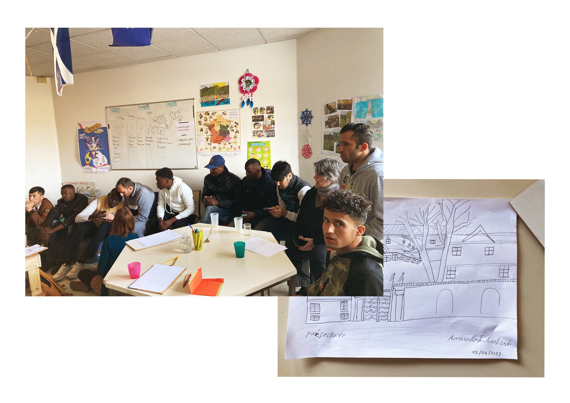
Overall, the experience was highly positive for the participants, the hosting association, and the volunteers. It was particularly remarkable to witness a 19-year-old participant drawing for the first time in their life, an experience that was truly exceptional. However, when it came to the creative portion of the workshop, some participants seemed unsure about what to do with the available materials. We adapted to the situation and made the best of what we had, guaranteeing support and a joyful non-judgmental attitude.
A local radio station was involved: "Antenne d'Oc," which broadcasts on the radio, allowing listeners to tune in online and on radio channels. A journalist conducted an audio interview about URBEX and interviewed our facilitator and some participants about their experience. The interview is available on the radio archive page, the focus on URBEX Local Lab starts at min. 12:38 and can be listened to here.
We were thrilled to facilitate an URBEX workshop in Cahors with such a remarkable group of participants as an exploration tool. The diverse mapping techniques we discussed offered new ways to amplify their voices, experiences, and stories. Subjective mapping allowed them to express their unique perspectives and engage with the environment in a meaningful way. By creating their own maps, they envisioned the possibility of reclaiming their narratives, fostering intercultural understanding, promoting active participation, and contributing to community development. This workshop provided an opportunity for empowerment, self-expression, and the discovery of their own personal geographies.
Through cartography, we hope to support and uplift these individuals, enabling them to navigate their new surroundings and find a sense of belonging and agency in their journey towards a brighter future.